why Macquarie Island deserves a bigger marine park
- Written by Ian Cresswell, Adjunct professor, UNSW Sydney

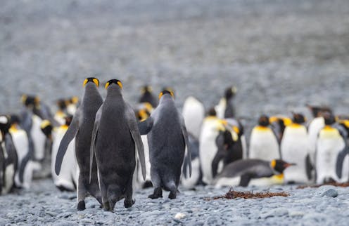
Macquarie Island, around 1,500km southeast of Tasmania, is more than just a remote rocky outcrop. In fact, it’s the only piece of land on the planet formed completely from ocean floor, which rises above the waves to form peaks that teem with penguins and other bird species, some of them found nowhere else on Earth.
These are just some of the reasons why this unique island, and the seas that surround it, have globally significant conservation values. Our new independent assessment of these values forms the scientific evidence base of Federal Environment Minister Tanya Plibersek’s announcement last month of plans to significantly increase protections for the waters surrounding Macquarie Island.
By comprehensively assessing the available data on the marine ecosystems and the many species that live on and around Macquarie Island, our report reveals a subantarctic environment that is crucial for breeding and feeding for millions of seabirds and thousands of marine mammals.
Macquarie Island and its surrounding seas (to a distance of 5.5km) are already protected as a Tasmanian reserve, and the area (this time including seas to a distance of 22km) is also a World Heritage Area. A Commonwealth marine park also covers most of the southeast quadrant of the island’s “economic exclusion zone”, including a sanctuary zone and two seafloor management zones.
The federal government’s proposed expansion of the marine park would cover the island’s entire economic exclusion zone, increasing the area of Australia’s marine sanctuaries by more than 388,000 square kilometres, an increase larger than the area of Germany.
An outstanding spectacle
Macquarie Island is the exposed crest of the 1,600km-long undersea Macquarie Ridge, which makes Macquarie Island the only piece of land in the world formed entirely of oceanic crust.
Macquarie Ridge is one of only three such ridges that impede the eastward flow of a current called the Antarctic Circumpolar Circulation, resulting in distinct differences between the west and east sides of the ridge, which are used in different ways by different species.
The oceanography is further divided north to south by two major ocean fronts, the Sub-Antarctic Front and the Polar Front, creating three distinct bodies of water. They are closer here than anywhere else in the Southern Ocean, and as they interact with the Macquarie Ridge create at least six different large-scale oceanographic habitats.
This creates an outstanding spectacle of wild, natural beauty and a diverse set of habitats supporting vast congregations of wildlife, including penguins and seals. Fifty-seven seabird species, including four species of penguins and four species of albatross, have been recorded on Macquarie Island, and 25 of these species have been observed breeding there. The royal penguin and the Macquarie Island imperial shag live nowhere else on Earth.
The ridge includes a series of undersea mountains that act as “stepping stones” linking subantarctic and polar animals on the sea floor, such as brittlestars.
Read more: Enjoy them while you can? The ecotourism challenge facing Australia's favourite islands
Needing more protection
Our report shows the area around Macquarie Island is not well represented by the current marine park. In particular, the entire area to the west, and most of the northern and southern parts of the Macquarie Ridge, are not protected by the current marine park, but will be included in the proposed expansion.
Our report also considers several options for protecting the area’s unique ecosystems and concludes that the most sensible approach, given the available data, would be to declare the whole area around the Macquarie Ridge as a marine park, increasing the protection outside the current sanctuary zone, while allowing the current fishery to continue in a habitat protection zone.
This provides the simplest, most expeditious reserve design that is relatively easy to implement, achieves environmental protection and sustainable fishing, recognises the importance of the entire Macquarie Island region, and provides the most resilience to climate change.
Direct human impacts in the area are predominantly due to fishing and marine debris, although climate change is an ever-present threat too. The fishery targets the deepwater Patagonian toothfish using bottom longlines, mostly in the central zone of the Macquarie Ridge. This fishery is generally well regarded for its best-practice fishing methods and commitment to positive environmental outcomes, and this fishing activity would continue under the new plans.
But if new fisheries were allowed to develop targeting midwater species, or new industries such as seabed mining were permitted, these could directly impact the seabirds, marine mammals and other species that live in these areas.
The proposal put forward by Minister Plibersek protects all of the Commonwealth waters in two different zones of a marine park, effectively tripling the size of the current marine park. It protects the marine domain and allows the current fishery to continue without significant changes to current practices or catches.
Restrictions on any potential future fisheries would be determined by the distribution of “sanctuary zones” which would preclude fishing, and “habitat/species zones”, which could accommodate sustainable fishing. Mining would be precluded under either category of protection.
Read more: Disruption over Macquarie Island calls for some clever Antarctic thinking
What next?
The government’s proposal signals a clear priority for protection over development in this area. A period of public consultation on the proposal will commence in March. Any future development of the marine park would need to be orderly and careful, including prior consideration of environmental impacts. Any changes to the current fishery management arrangements should ensure that the changes maintain or enhance conditions for a long-term sustainable fishery.
More broadly, our report also demonstrates the potential for, and importance of, compiling the most up-to-date available data for any region prior to any formal review process to update Australia’s marine park network.
The authors thank Anthony D. M. Smith for his contribution to this article and the report on which it’s based.
Authors: Ian Cresswell, Adjunct professor, UNSW Sydney


